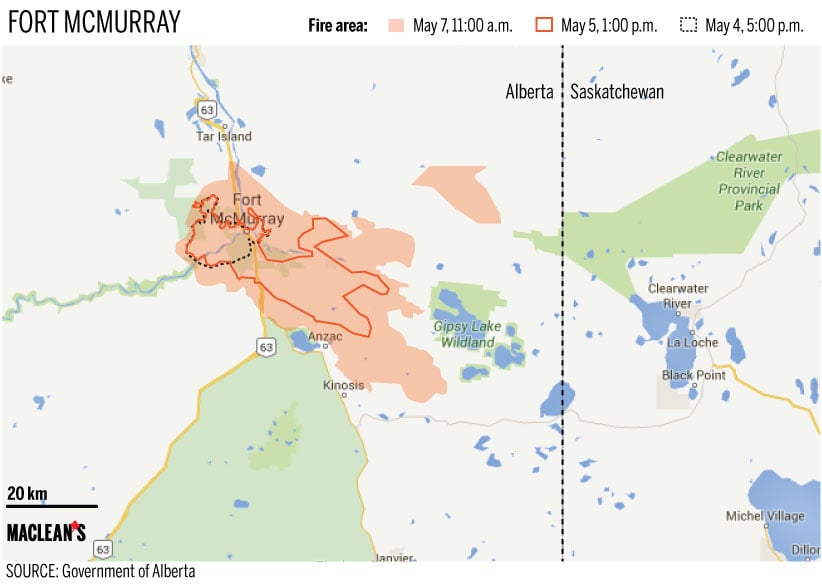
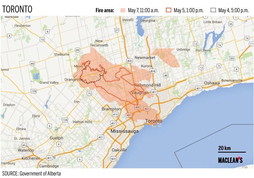
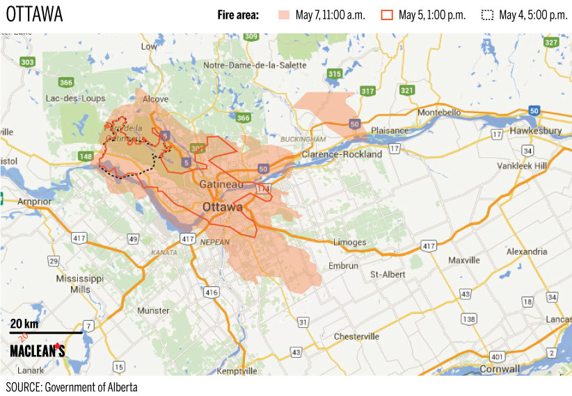
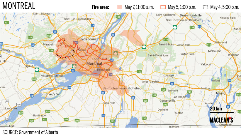
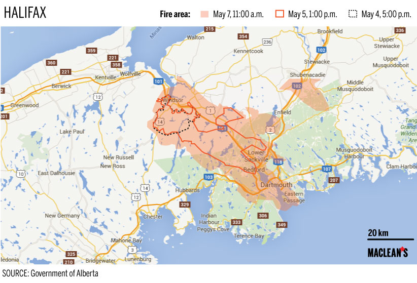
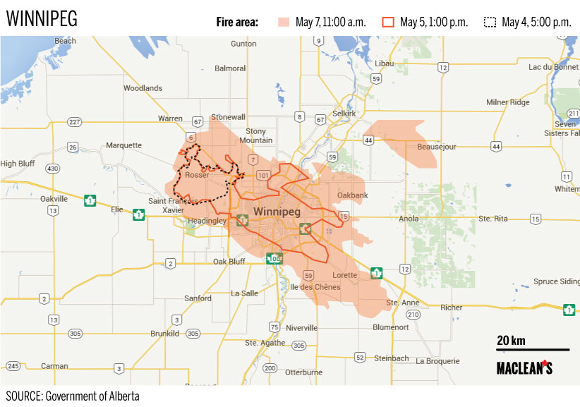
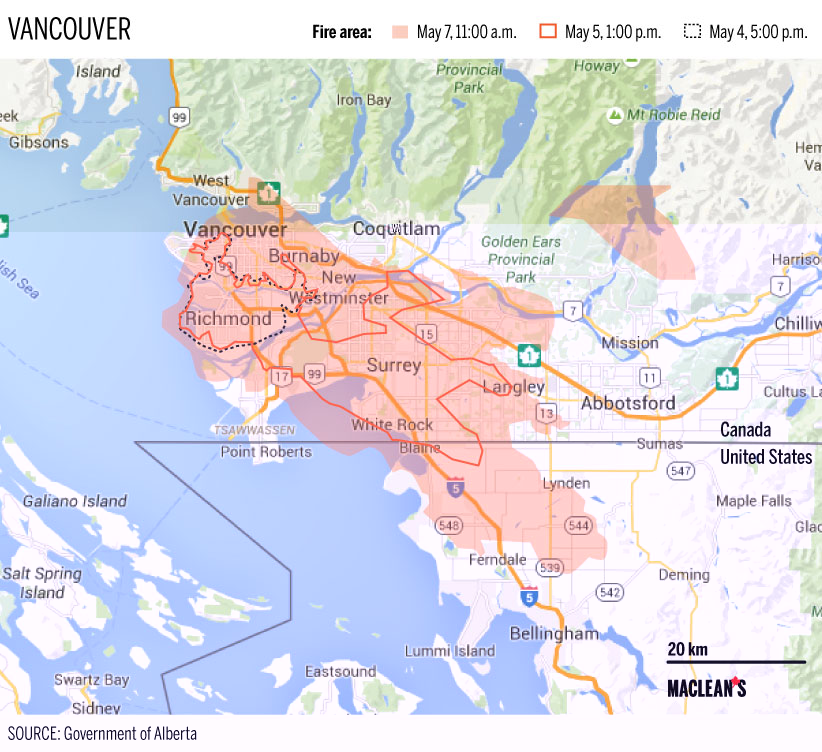
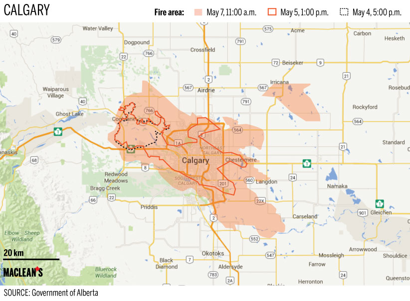
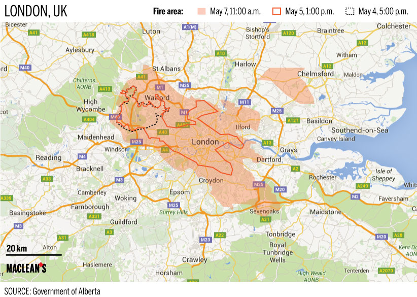
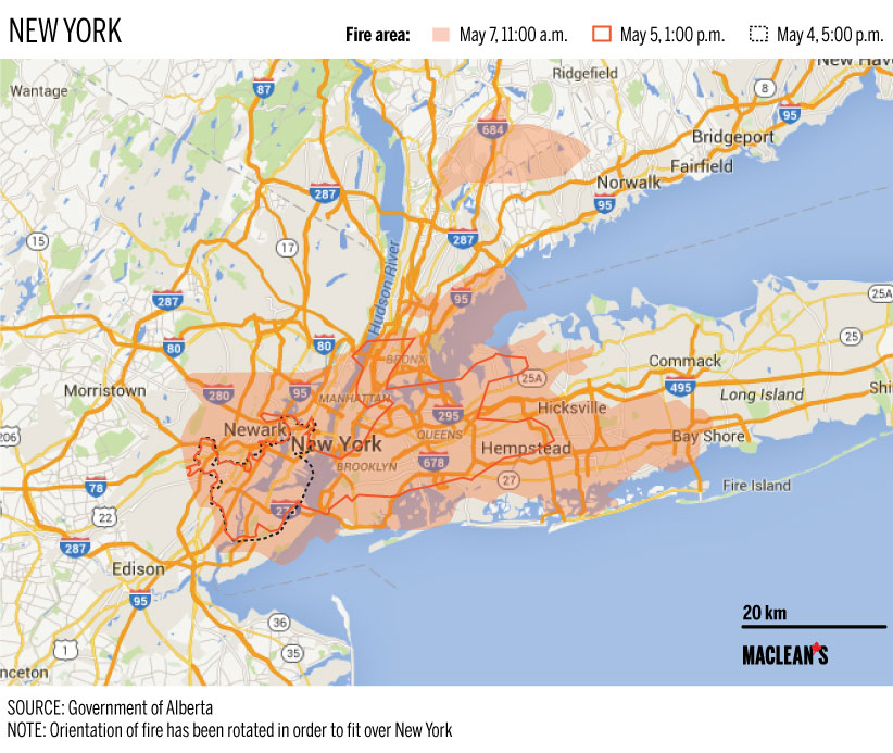
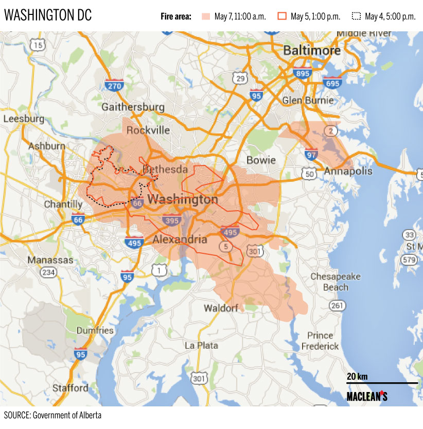
How big is the Fort McMurray fire?
Maclean’s is using the latest data to track the growth of the Fort McMurray fire and to see what it looks like when superimposed on maps of other cities

Share
(This post has been updated)
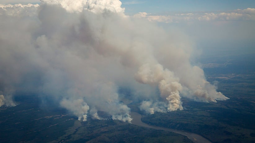
The Fort McMurray fires continue to grow. On Thursday morning Maclean’s published a series of maps showing Canadian and international cities superimposed with the burn area of the Fort McMurray fire. Those maps reflected the size of the fire as of 5 pm Alberta time on Wednesday. Yet by Thursday afternoon the government announced the fire area had increased dramatically to 85,000 hectares, and has continues to sprawl in the days since. Below are updated maps showing the original fire zone, marked by dotted lines, along with the iterations of new data (the latest coming on Saturday, May 7, at 11 am) to give a sense of how it has grown.