What will winter 2018 be like in Canada?
December should be cold in the east and warm in the west—but February could be a different story
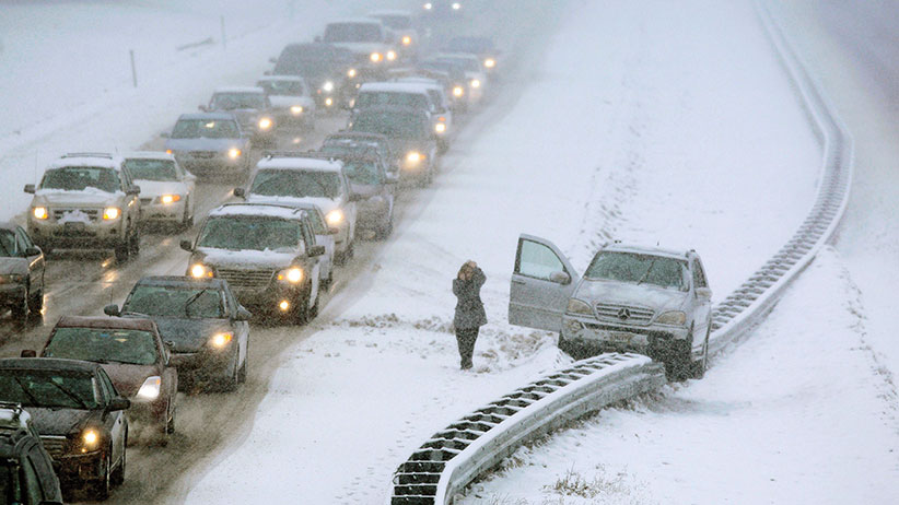
A woman uses a cell phone after climbing out of a vehicle that ended up on a guard rail in the median of Interstate 295 during a snow storm in Cumberland, Maine, Friday, Feb. 25, 2011. (AP Photo/Robert F. Bukaty)
Share
A building La Niña will be the main driver for a long-term weather this winter. Common elements of La Niña include a large ridge of high pressure located over the Pacific Ocean and occasional troughs of low pressure over the eastern portion of North America. This usually stirs up a wet winter for the western portions of North America and can bring in additional moisture to the southeastern portions of Canada.
Climate signals are predicting slightly above rainfall and cooler conditions for western Canada and a near-average winter for central Canada. However, farther east, climate signals are more mixed. The average jet stream location will make a big difference for portions of Ontario and Quebec this winter. If the jet stream is farther south, we could see cooler than average temperatures expand eastward from the Pacific to the Atlantic. Currently, though, the jet stream is and has been riding farther north, so warmer conditions will be possible for southeastern Canada. This could also bring more precipitation to the border region from the Pacific east to the Atlantic coast.
READ MORE: Canada: A nation of winter wusses
At the moment, we’re expecting a temperature flip-flop from December through February. For instance, December is expected to be cold in the east and warm in the west…and the opposite for February (warm in the east and cool in the west). Exactly what wins out in the long term remains to be seen.
What might temperatures be like for Canada in 2018?
Near average or cooler than average temperatures possible for: Quebec (Dec.-Jan.), central and southern portions of Ontario (Dec.-Jan.), the Yukon (Feb.), Manitoba and Labrador
Near or above average temperatures possible for: British Columbia (Dec.-Jan.), southern Alberta (Dec.), eastern Ontario (Feb.), Saskatchewan (Dec.) and the eastern maritime provinces excluding Labrador and Nova Scotia.
Above average temperatures expected for: Nova Scotia
RELATED: How to survive a North Pole storm
What might precipitation be like for Canada in 2018?*
Near or above average precipitation expected for: southern Ontario, southern Alberta, southern Saskatchewan, British Columbia, Nova Scotia and Newfoundland
Near or below average precipitation possible for: for northern Quebec and eastern Nunavut
*Please note that a pattern and temperature change is anticipated mid-winter, so many provinces will start with above or below average temperatures and finish the winter with the opposite temperatures. Moreover, these forecasts are for a three month period (December to February); some forecasts are only valid for certain months and are marked as such. Intrusions of well-below or well-above precipitation or temperatures could occur anywhere for much shorter periods of time. These intrusions would need to be monitored on a timescale of days or weeks rather than months. For more updates, check back with weather.com/en-CA.
MORE ABOUT WEATHER:
- ‘It looked like a spaceship’: What it’s like to be caught in a sandstorm
- ‘Run! It’s coming this way’: What it’s like at the centre of a tornado
- ‘It came right through the shop’: How to endure a B.C. mudslide
- ‘This is like a living thing’: How it feels to escape a wildfire
- ‘You don’t know what’s under your feet’: How to survive a North Pole storm
- ‘I felt awe and fear’: New Orleans in the middle of Katrina
- Why it’s snowing in Alberta and boiling hot in Ontario and Quebec