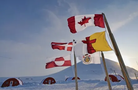
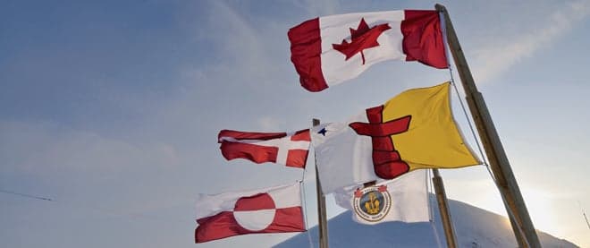
Who owns the North Pole?
The ancient Norsemen believed the mountains and oceans were made from the remains of Ymir—an unlucky “frost ogre” whom the gods slaughtered for the purpose of creating the world. Odin and company were not known for tenderness, but they must have had a sense of humour. The undersea mountain range they left at the top of the planet makes that much clear.
Known as the Lomonosov Ridge, this towering, silt-covered furrow on the ocean floor begins from the nexus of Ellesmere Island and Greenland, then runs some 1,800 km beneath the polar ice cap to an archipelago called the New Siberian Islands. About halfway across, there is a single jag that sticks a couple of hundred kilometres toward the Barents Sea. And there, just below the point of the elbow, under about 4,200 m of frigid water, lies the geographic North Pole.
If they’d had degrees in international boundary law, the creators of the Lomonosov Ridge hardly could have concocted a surer recipe for 21st-century trouble. The Russians laid claim in 2001 to a section of it that includes the pole, and a glance at a relief chart would suggest their claim has merit. By all appearances, the ridge is an extension of the Eurasian continent. Then, last month, leaked documents revealed Danish plans to put dibs on the range based on Greenland’s proximity and apparent geological connections to it. Not to be outdone, Canada is preparing its own claim on territory we’ve long romanticized but historically ignored: this summer, our scientists will take the last in a series of Arctic research voyages intended in part to prove the Lomonosov Ridge is a “natural prolongation” of Ellesmere Island, which it also appears to be. We’re gathering our information with the help of Denmark and the United States—the better to save money and avoid future disputes as to the findings. But make no mistake, we’re in it for ourselves.
The project has amassed an impressive array of data, from the depth of silt across our Arctic shallows to the constitution of the rock going 40 km down. But the geological origins of the Lomonosov Ridge? Well, that’s not so clear. “Russia says it’s a prolongation of their margin, we say it’s a prolongation of ours,” concedes Jacob Verhoef, the federal geologist in charge of Canada’s research mission. “I think the end result is that we both are right.”
That’s a greater level of candour than one hears these days from Moscow, where political leaders speak as though Russia’s Arctic claims require nothing more than the UN’s rubber stamp of approval. But Verhoef’s words are also an acknowledgement that after more than a century of superhuman effort—ill-fated sea voyages, sled-dog expeditions, low-altitude flyovers—we are no closer to answering a question that goes to the heart of any Arctic country’s identity: who, if anyone, owns the North Pole?
We used to think it was ours. Back in 1925, Canada raised eyebrows around the world by declaring as our maritime boundaries the 60th and 141st western meridians, a pie-slice expanse between Alaska and Greenland that converged at, and presumably included the pole. A few months later, the Soviet Presidium passed a law declaring an even larger Arctic domain on its side of the globe, while the recognition of Greenland as Danish territory in 1933 suggested a potential claim for that country between the 60th and 10th western meridians. Both extended in a triangular form toward the pole, as per the so-called “sector principle” countries used at the time to determine polar boundaries.
These declarations were driven in part by fears of U.S. expansion in the region, and in part by the romance of the era, typified by American explorer Robert Peary’s disputed claim that he reached the North Pole in 1909. But given that the waters in question were encased year-round in ice, none of it much mattered. Even the arrival of the Cold War, with its nuclear-powered subs and long-range bombers, failed to solve the challenge of establishing a meaningful presence in a zone where temperatures averaged -34° C and ice lay four metres thick on the water.
Change, however, was on the way, and few witnessed its impact like Richard Weber, an adventure guide from Alcove, Que., who has made six voyages to the North Pole in the last quarter of a century. Weber, now 51, vividly recalls his first trip in 1986, an American-led sled-dog expedition that took him across plains of ice dozens of kilometres wide to the mountainous pressure ridges at the edges of each pan. “I’m talking 40-feet-high, multi-storey walls where the pieces had bumped up against each other,” says Weber. “You’d have chunks of ice eight feet thick, three of them on top of each other.”
But on his last trip, in 2010, those blue walls had all but disappeared—victims of the rapid warming of the polar climate. In their place lay long expanses of crumpled ice just a metre thick, punctuated by the occasional ridge that stood two or three metres high. In the summer, puddles of water now form on top of the pans, then freeze into mini ice rinks. “You never used to see that,” says Weber, a former member of Canada’s cross-country ski team who has travelled to the pole by both ski and snowshoe. “It never used to get above freezing.”
The geopolitical implications of this transformation are nearly as great as the ecological ones. With the northern climate warming by an estimated 0.3° C per decade, and ever larger pieces breaking off the northern ice cap, some estimates predict ice-free summers at the pole within the next 25 years. It’s not inconceivable that icebreakers might make annual trips to the region within the next decade, opening routes for conventional vessels of their choosing. “I’ve been joking with a friend of mine that pretty soon we’re going to travel to the pole by sailboat,” says Weber.
All of which has lent renewed relevance to the question of who will hold sway over this tract of the globe once it becomes navigable. Control of the waters themselves has been settled by the 1982 UN Convention on the Laws of the Sea (UNCLOS), which limits every country’s “exclusive economic zone” (EEZ) to 200 nautical miles from their coastlines. That’s the area in which a coastal country can regulate fishing, oversee marine traffic and impose some of its laws. But the nearest piece of land to the pole lies 700 km away, on the northern tip of Greenland.
The issue of who controls the sea floor, however, has never been more live, and that’s where the Lomonosov Ridge comes in. Under the 1982 convention, countries can claim additional expanses of seabed if they can prove them to be “natural prolongations” of their continental shelves. If approved, those claims would give them rights to mine the ocean floor for oil, gas and precious metals.
The limits to these claims are complex and fungible, taking into account everything from gradients of the shelf to the thickness of sedimentary rocks. A country can, for example, claim up to 350 nautical miles of seabed that extends from its coastlines. Alternatively, it can claim 100 nautical miles from the point where the water first hits a depth of 2,500 m—a rule that might well determine ownership of the North Pole. The pole lies, after all, within about 50 nautical miles of the Lomonosov Ridge, and whether you start from Canada, Greenland or Russia, the waters over the ridge rarely exceed 2,500 m (it gets as shallow as 954 m). Those undersea mountains, therefore, could easily be considered somebody’s continental shelf, which means the pole could become someone’s bit of seabed. The question is whose.
Truth is, the pole itself may not be the chief attraction. “It’s just a point in the Arctic Ocean,” says Frédéric Lasserre, a Laval University professor who studies Arctic sovereignty issues. “Its value is symbolic and that’s all.” In an interview published in 2007, Russia’s natural resources minister, Yury Trutnev, laid bare Moscow’s primary motivation by boasting (somewhat fancifully) that winning the ridge could allow his country to claim up to five billion tonnes of petroleum reserves in the area. By then, Russian researchers had reached the area by submarine, run a battery of geological tests on and around the ridge and flatly declared its origins to be Russian. They even planted a titanium flag on the ocean floor at the pole.
“This isn’t the 15th century,” Peter MacKay, then Canada’s foreign minister, snapped in response. “You can’t go around the world and just plant flags.” But from that point, the race for possession unfolded with remarkable civility. Submissions to extend continental shelves are adjudicated by a special UN commission set up for the purpose, and countries must make their claims within 10 years of ratifying the UN Convention on the Laws of the Seas. For Canada, that date is December 2013; for Denmark, 2014. The Russians showed customary zeal by submitting their claim six years earlier than necessary, only to have it sent back for lack of scientific proof. They are expected to resubmit it within the next two years.
Everyone seems inclined to live with the commission’s decision, and all three countries, along with the Americans, have pooled resources at some level to collect the necessary data (the U.S. has not ratified UNCLOS, but adheres to most of its provisions). That’s a good thing, because mapping the Arctic sea floor is expensive and difficult. “You can’t tow seismic equipment behind an icebreaker like you would on a normal ship, because an icebreaker has to stop and back up,” explains Verhoef, director of Canada’s part in the research. “You wind up backing over the cables.”
In the Western Arctic, the American icebreaker Healy and Canada’s Louis S. St-Laurent took turns turns cutting paths while the other towed the equipment. Then, beset by ice shards in the water column, researchers improvised, amping up the sound waves on their probes to cut out interference. Off Ellesmere Island, Canadian and Danish crews got downright aggressive, drilling holes in the ice and detonating TNT about 100 m below the surface to chart the composition of the Earth’s crust. “Then you can use seismometers to see the layers of rock 40 km down,” says Verhoef with detectable pride. “It’s a very intensive operation.”
The results were published in a peer-reviewed journal, and for Canada, the news is mixed. While the Lomonosov Ridge appears to have moved together over the last 50 to 55 million years with Ellesmere Island and Greenland, suggesting it is part of the North American shelf, the range also seems to have moved in concert with the Siberian land mass. “We could make a case that it is part of Canada,” concludes Verhoef. “But based on the same information, others say the same thing.”
Indeed, the commission might well find that all three claims are valid, in which case the countries will be left to resolve the overlap themselves. That’s fine as long as everyone continues to get along, but in the end, possession of the pole may well come down to who establishes the most forceful presence there first. In short, Peter MacKay had reason to worry about that titanium flag.
What, then, is the North Pole worth to Canadians? To date, we have spent $109 million on the Verhoef-led research initiative, and while extending our seabed rights would likely pay dividends in the form of oil, gas or mineral reserves, any battle we wage for possession of the Lomonosov Ridge must be weighed against the value of resources it contains. And for now, no one’s entirely sure what’s there. Minister Trutnev’s “five billion tonnes of fuel” stands in stark contrast to estimates by the U.S. Geological Survey, which suggest only 1.1 billion barrels of oil in the Lomonosov area, or about 1.3 per cent of annual global consumption.
Given these modest projections, some experts see ownership of the pole as a red herring. “I’m more concerned about what’s going to happen to the ocean,” says Shelagh Grant, the Canadian author of Polar Imperative: A History of Arctic Sovereignty in North America. An ice-free pole means oil, gas and other materials will be shipped along ecologically sensitive parts of the Canadian North, she points out. “And sailing in ice-infested waters is dangerous, even if it’s small pans.” Factor in news that China has commissioned its own icebreakers, or Washington’s steadfast refusal to recognize the Northwest Passage as Canadian waters, and the pole looks a whole lot less important than the security of our own shorelines. Grant, for one, is urging Canada to step up its icebreaker program to establish at least de facto control of our territory.
Still, even the most cynical realists acknowledge the pole’s mystical draw—a pull as strong in its own way as that of its magnetic sibling. “The prize of three centuries, my dream and ambition,” was how Peary described it in his diary on April 1909. Weber offers a more modern, if less lyrical summation: “When you have your GPS, and you walk up to it, and you know you’re standing on top of the world, well, that’s pretty cool.” Whether that X factor is sufficient cause to embark on a diplomatic battle, or to deplete the public treasury sending people and equipment to the roof of the world, is open to question. But if you think you might have something cool, chances are you want to hang on to it. You’d certainly hate for someone else to take it away.
Get the Best of Maclean’s straight to your inbox.
Sign up for news, commentary, analysis and promotions. Join 80,000+ Canadian readers.